Case Study: Advancing AgTech with Groundbreaking Satellite Imagery
Dave Gebhardt, Vice President, Marketing & Strategy, GEOSYS
Jeff Rath, Executive Vice President, Corporate Finance & Strategy, UrtheCast
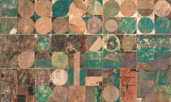
Many industries, including agriculture, are utilizing geospatial information to improve efficiency and productivity. By collecting and leveraging data and information associated with a location relative to the Earth, planting, watering and harvesting can all become extremely precise, reducing waste and improving yields.
In this case study from Geosys, learn about the pioneering earth imaging technology by UrtheCast, and how it can be coupled with data from remote sensors to measure the many factors affecting yield.
Learn more about this and other sessions.
Let GAI News inform your engagement in the agriculture sector.
GAI News provides crucial and timely news and insight to help you stay ahead of critical agricultural trends through free delivery of two weekly newsletters, Ag Investing Weekly and AgTech Intel.