February 14, 2018
Syngenta has added to its toolbox of farm management solutions with the acquisition of FarmShots, Inc., a North Carolina-based innovator of high-resolution satellite imagery that detects plant health by analyzing absorbed light from field images. Syngenta plans to fully integrate FarmShots’ technology into its AgriEdge Excelsior whole-farm management system in the U.S., followed by a global rollout. Terms of the deal were not announced.
“FarmShots is a new and unique service that helps us deliver on our commitment to further develop farm management and crop decision-making tools,” said Dan Burdett, head, Global Digital Agriculture, Syngenta. “We expect to incorporate FarmShots into our digital portfolio and rapidly accelerate growth from the current eight million enrolled acres in the United States, and globally soon after.”
Imaging Technology is a Focus for Investors
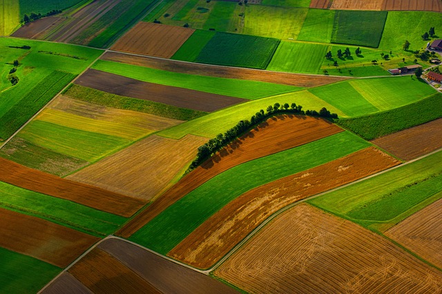
Agriculture operators are increasingly utilizing geospatial information to improve efficiency and productivity. By collecting and leveraging data and information associated with a location relative to the Earth, planting, watering, and harvesting can all become extremely precise, reducing waste and improving yields. In addition to satellite data, drone and aircraft remote sensing data is also being heavily utilized.
In the last six months alone, a number of global deals have raised the profile of this agtech segment.
Just a month ago, Syngenta’s venture arm was one of several backers of a $75 million Series D round raised by drone technology company PrecisionHawk, which sells drone hardware, sensor technology, and provides analytics capabilities. And SkySquirrel, a Halifax, Canada-based permanent crop-focused drone company, announced it has raised $3 million in follow-on funding backed by Innovacorp, an existing investor in the company, and an unnamed private investor from Ontario, Canada. The company also has announced its merger with Napa Valley, California-based VineView Inc. to create a new aerial imaging and crop diagnostic company called VineView.
In 2017, Ceres Imaging, an ag-focused aerial spectral imaging and analytics startup, secured an additional $2.5 million in Series A funding from Romulus Capital, bringing the total round to $7.5 million.
Outside of North America, Nileworks, a Japanese agtech company focused on the development of hyper-precise agricultural spray drones, announced the successful raising of 800 million yen (approximately US$7 million). Involved investors include Japan’s National Institute of Industrial Innovation, Kumiai Chemical Industry Co., Sumitomo Corporation and its subsidiary Sumitomo Chemical Co. Ltd, the National Federation of Agricultural Cooperatives, and the Norinchukin Bank.
Imaging Data has Varied Uses
Imaging data can be utilized all along the ag value chain. In the issue of GAI Gazette published in conjunction with GAI Europe, imaging industry leader GEOSYS explained how such data is being used by the crop insurance industry to increase operational efficiencies, manage exposure to risk, and provide substantiated validation when evaluating a loss claim.
By David Nitchman, GAI Media

Let GAI News inform your engagement in the agriculture sector.
GAI News provides crucial and timely news and insight to help you stay ahead of critical agricultural trends through free delivery of two weekly newsletters, Ag Investing Weekly and AgTech Intel.


